
Article by Geoff Welch with material from Gale Pasha of the Rockland County Sierra Club
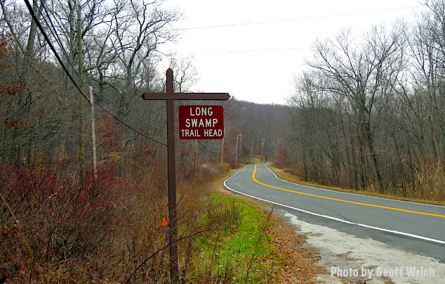
Long Swamp Trail Head skirts the Village of Sloatsburg and is the southernmost trail in Sterling Forest State Park — the Pilgrim Pipelines current route is proposed to cross the Orange/Rockland county lines near the trail head.
It was disclosed in November 2015 that Pilgrim Transportation of New York, Inc. had filed an application for permits to use the Right of Way for the New York State Thruway Authority as the main New York route for two proposed pipelines to run from Albany to Linden, New Jersey.
Pilgrim Pipeline will be part of the Town of Ramapo meeting Wednesday evening at 8 p.m. At issue is the proposed pipeline route and which agency might best serve as lead on the issue — the NY Department of Environmental Conservation (DEC) or New York Thruway Authority. The deadline for municipal response on the matter is December 16.
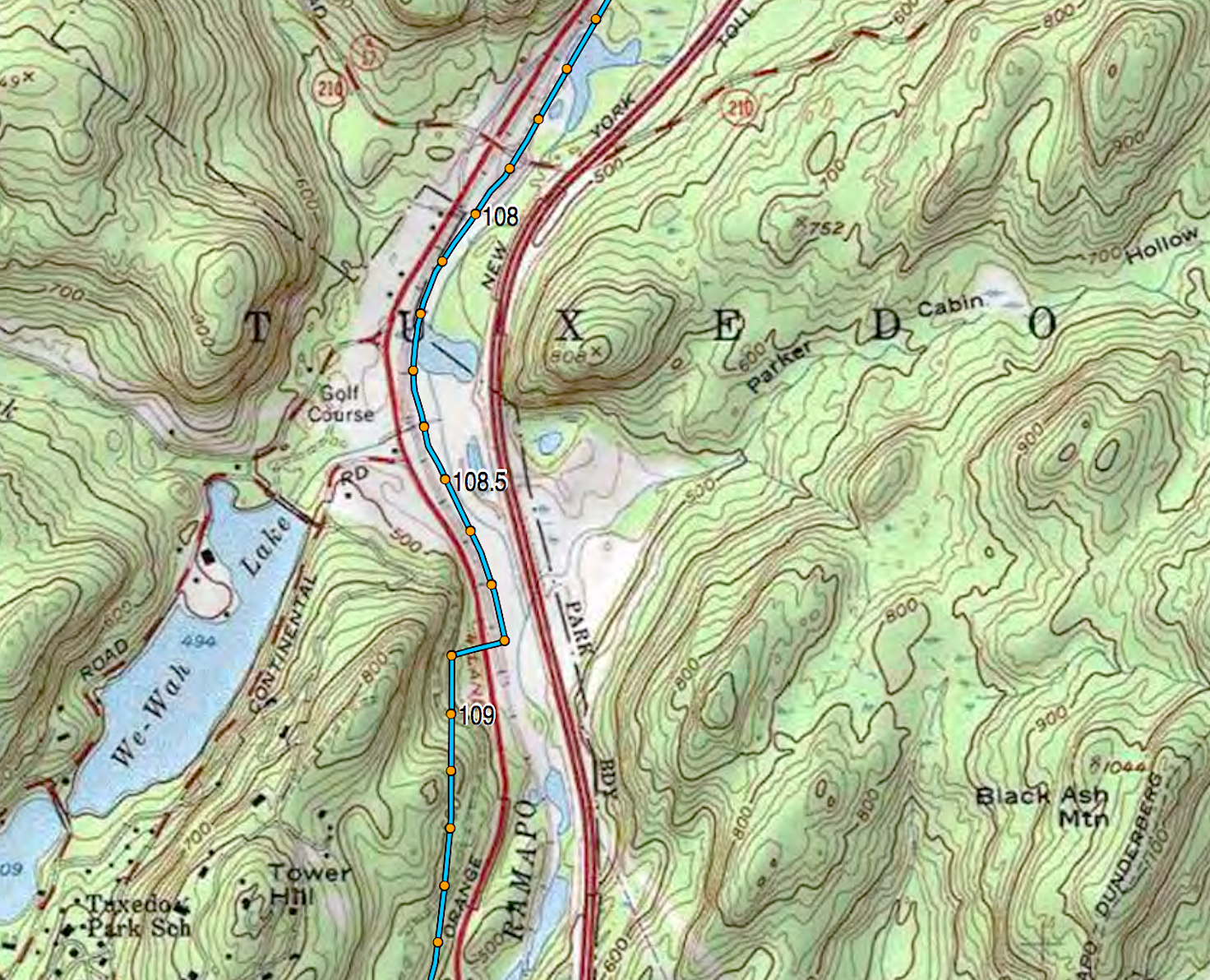
Proposed route of the Pilgrim Pipelines through the Town of Tuxedo which will run through sensitive wetlands along the Ramapo River. Click map to enlarge.
Bakken crude oil and possibly tar sands oil would be carried south and refined products such as kerosene, aviation fuel and gasoline would be carried north. All are highly volatile and crude oil explosions alone have caused billions of dollars of damage and have devastated communities in the US and Canada.
The Pilgrim pipelines would run for miles along the Ramapo River in Orange County, from Woodbury south to Tuxedo, posing a grave threat to the water supply of Rockland County downstream. Even small leaks, which are common, could flow south and contaminate the water supply of the Ramapo well fields in Torne Valley, which supplies one-third of Rockland County’s drinking water.
Wetlands area in Sloatsburg that runs between Eagle Valley Road and Sterling Mine Road where the proposed Pilgrim Pipelines may run 6 feet underground.
When larger breaks occur, pipelines can discharge hundreds of thousands of gallons of toxic pollution producing a catastrophic event. Aquifer public water supply wells line the Ramapo River from Torne valley NY to Pompton Lakes, NJ.
A pipe connection in Pompton Lake carries up to 150 million gallons of water per day west to New Jersey’s largest reservoir in Wanaque.
The Ramapo River watershed is classified as a Federal Sole Source Aquifer and supplies all or part of the water for over 2 ½ million people in NY and NJ.
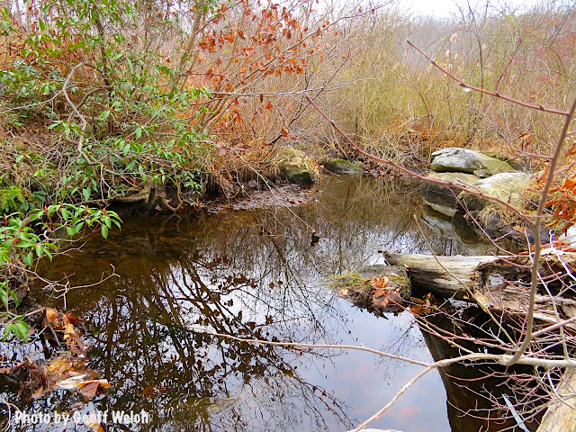
Nakoma Brook in the area where the Pilgrim Pipelines propose to cross
In Rockland County, the proposed route would also threaten the watershed of the Nakoma Brook, an important tributary of the Ramapo River which flows east into the Village of Sloatsburg, past homes and community athletic fields before entering the Ramapo River less than 1 ½ miles upstream of the public water supply wells in Torne Valley.
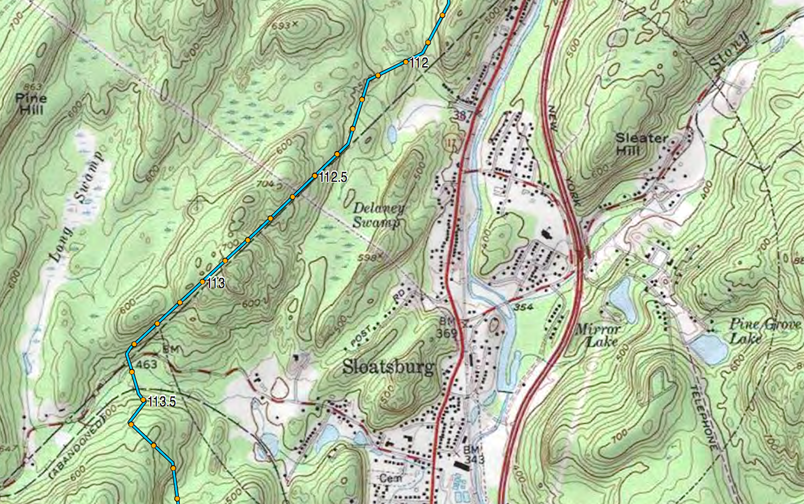
Proposed route of the Pilgrim Pipelines adjacent to Sloatsburg and set to pass between Cranberry and Potake Lakes in the Ramapo Mountains. Click map to enlarge.
The pipelines route would also pass between Cranberry and Potake Lakes in the Ramapo Mountains. Suez Water New York owns Potake Lake which releases water via a pipe into Nakoma Brook. This augments the flow of water in the Ramapo River attempting to achieve DEC flow requirements of at least 8 million gallons a day at the USGS gaging station in Hillburn. This is an issue usually in the summer.
The average flow of the Ramapo River is 110 million gallons a day.
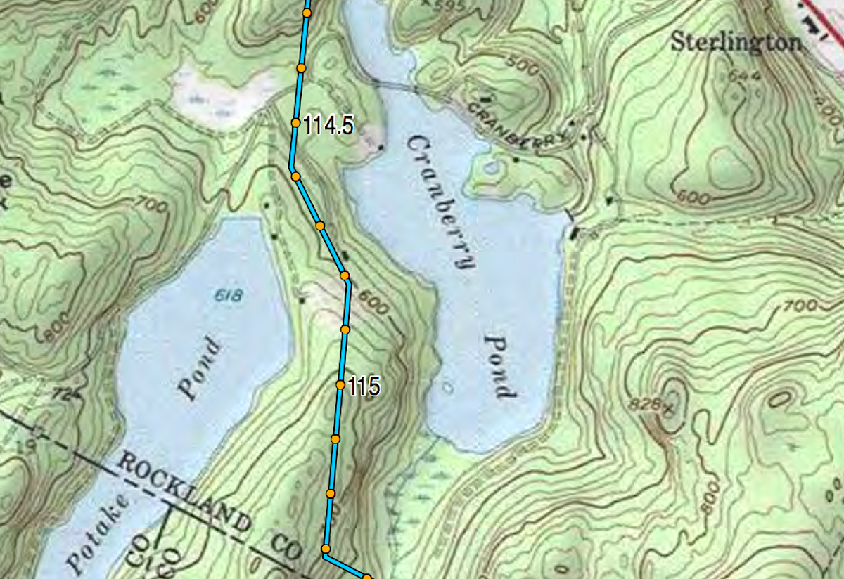
Detail of the proposed Pilgrim Pipelines route through Pierson Lakes as it slices between Cranberry and Potake Lakes. Click map to enlarge.
The rush to pump the remaining “dirty” oil deposits out of the ground releasing more CO2 and other greenhouse gases will act to make the climate warmer still, with even more intense storms and rising ocean levels.
We need instead to be lowering our use of fossil fuels as quickly as possible over to solar, wind, geothermal etc., with advanced conservation. Currently, The world is belatedly dealing with climate change at the conference underway in Paris.
For towns in Rockland County that are currently threatened by daily crude-by-rail traffic and which are also in the path of the proposed pipelines, approval of the pipelines will exponentially increase the risks they face. The pipelines would not replace the trains or the barges on the Hudson. It will increase the dangers.
Since the DEC is responsible for protecting New York rivers, tributaries, wetlands and other environmental resources, the DEC, not the Thruway Authority, has the expertise to guide the environmental review of this project.
Six New York counties and 29 towns will be impacted by these pipelines. New Jersey should be at the table also. There may also be some other legal means to halt this alarming project.
