
 Just in time for the spring thaw and warm weather, the New York/New Jersey Trail Conference has announced brand new Harriman State Park Trail maps, complete with trail junction to trail junction mile mileage.
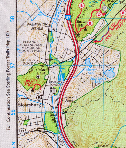
New NY/NJ Trail Conference Harriman Bear Mountain trail maps now have trail junction to junction mileage — and the Sloatsburg Liberty Rock trail is included on the new maps.
MyHarriman first reported about the new maps, including a helpful tip on how to store any old trail maps — frame them and hang’m up on the walls.
The new trail maps are available at Hayward’s Deli, located in the center village in Sloatsburg.
The maps also include the new Sloatsburg Liberty Rock Trail which winds up at the well known Liberty Rock outcrop overlooking Sloatsburg. Liberty Rock Park was purchased by the Town of Ramapo in 2008 and now serves as 54 acres of preserved green space and town park land. A local group, spearheaded by members of the Friends of Harmony Hall, worked with the NY/NJ Trail Conference on the trail that will serve as an official hiking trail up the historic lookout.
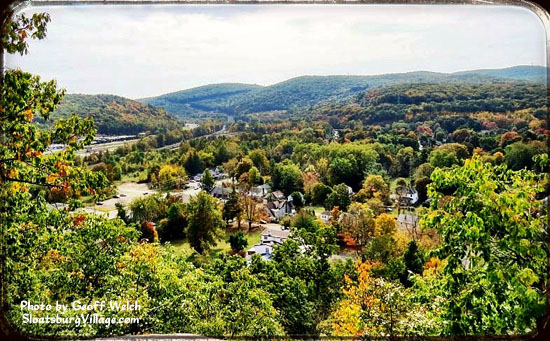
View from Liberty Rock Trail, overlooking Sloatsburg, NY.
The Liberty Rock Park parcel of land was once part of Harmony Hall and Jacob Sloat’s extended Sloatsburg property. The top of Torne Mountain can be viewed to the east, while the western view of Liberty Rock offers a view across Sloatsburg to Sterling Forest.
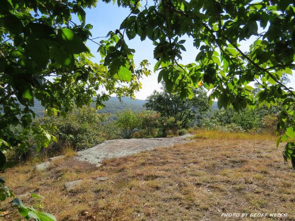
The approach and opening at Liberty Rock in Sloatsburg, NY.
The Harmony Hall trail up to Liberty Rock begins near the Sloatsburg Senior Center and follows a ravine up through the woods, looping around to Liberty Rock and the scenic overlook.
The prominent Liberty Rock outcrop provides a picturesque view of the village and Ramapo Pass, and was once part of the Jacob Sloat estate. According to local lore, the outcrop may have been a beacon fire rock during the Revolutionary War. Beacon rocks were often used during that time to communicate important information to far off geographical locations. Torne Mountain was used as a beacon rock to announce the end of the Revolutionary War. As noted on an 1861 survey map of the Jacob Sloat property, known as Harmony Hall, Liberty Rock was once called Liberty Pole Rock.
