
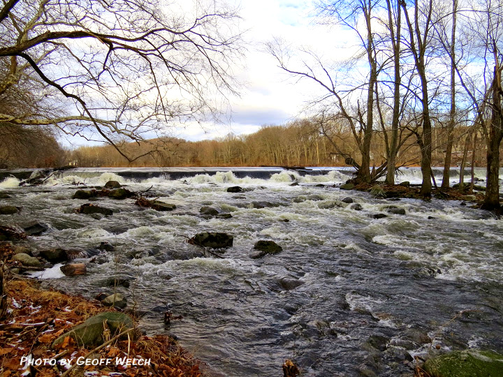
View of the Ramapo River as it washes over Sloats Dam in Sloatsburg, NY, with Mill Pond’s higher flat surface behind the roiled white water.
The Village of Sloatsburg has an industrial and commercial history going back to the mid-1700 Dutch settlers that included Stephen Sloat, who built Sloat’s Tavern. That original structure is still in existence at the rear section of the current Sloat House.
Mostly, the manufacturing history of the area centers on the power provided by the Ramapo River.
Brown’s Gate, located across from the Sloatsburg Train Station.
The Sloat House on Rt. 17 served as an important Sloat seat for several generations. Members of the Sloat family went out from the Sloat House and settled in other parts of what is now Sloatsburg, giving the village many of its historical touchstones, including the Sloat Dam and Mill Pond, Harmony Hall, the Nest house, home to Henry Sloat’s daughter, Carrie Sloat, the United Methodist Church land and original Chapel.
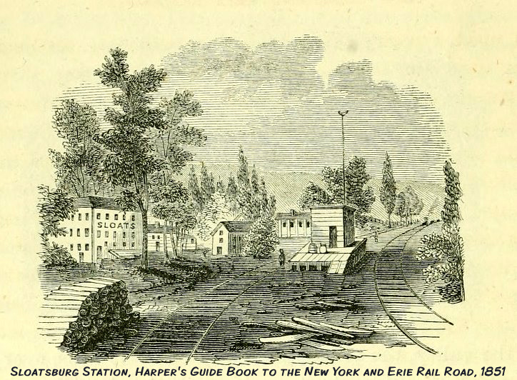
Harper’s Guide Book to the NY & Erie Railroads in 1851 shows Sloatsburg with businesses along the Ramapo River. In 1878, the Sloats sold their two-story brick facade mill along the Ramapo River.
Four properties in Sloatsburg associated with the Sloat family have been included in the National Register of Historic Places (NRHP).
As seen in a wood engraving from Harper’s Guide Book in 1851, most of Sloatsburg’s early industry and commercial ventures were located along the Ramapo River, with all of them eventually falling by the wayside due to periodic floods and deterioration — or as Woody Guthrie might have said, due to hard times.
The Sloats Dam with Mill Pond directly behind it. Both are on the National Register of Historic Places. As early as 1792 Isaac Sloat built Sloats Pond Dam to provide waterpower to run mills and other manufacturing.
Around 1900, Nicholas Brown acquired a large parcel of land along the Ramapo River north of the Sloatsburg Municipal Building. The property became known as Cappamore Farms and included the original dam built by Issac Sloat in 1792 to provide waterpower to run mills and other forms of manufacturing.
Isaac’s son, Jacob Sloat, built a textile mill at the site in the early 1800s and the Sloats dam is a rare remaining symbol of the early industrial era and the contribution to the development of the Village of Sloatsburg.
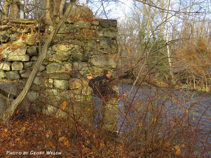
Ed Marse peeks around the remains of Brown’s Bridge, which at one time spanned the Ramapo River in Sloatsburg, leading to Cappamore Farms.
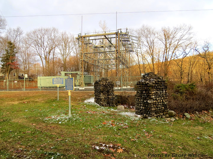
The entrance to Cappamore Farms is directly across from the Sloatsburg Train Station and included the two cobblestone gateposts, still standing, that served as an the property’s entrance way. The Sloatsburg Historical Society erected the blue and yellow metal historical marker that today fronts the entrance.
The construction of the New York Thruway in the 1950s cut directly through the Cappamore property which was demolished and the land given over for the highway construction project. The property included an iron bridge over the river, which was also torn down.
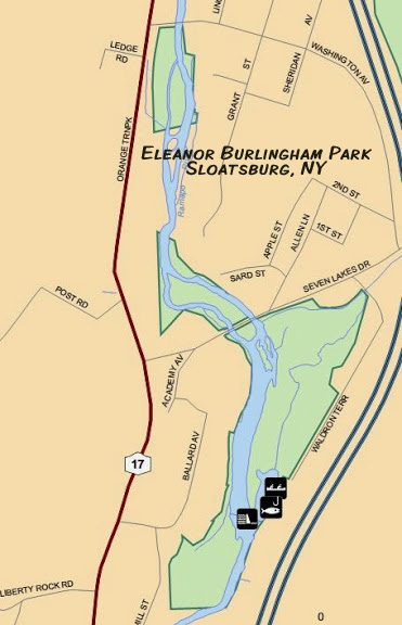
Eleanor Burlingham Park, a 45 acre undeveloped Rockland County Park along the Ramapo River in Sloatsburg.
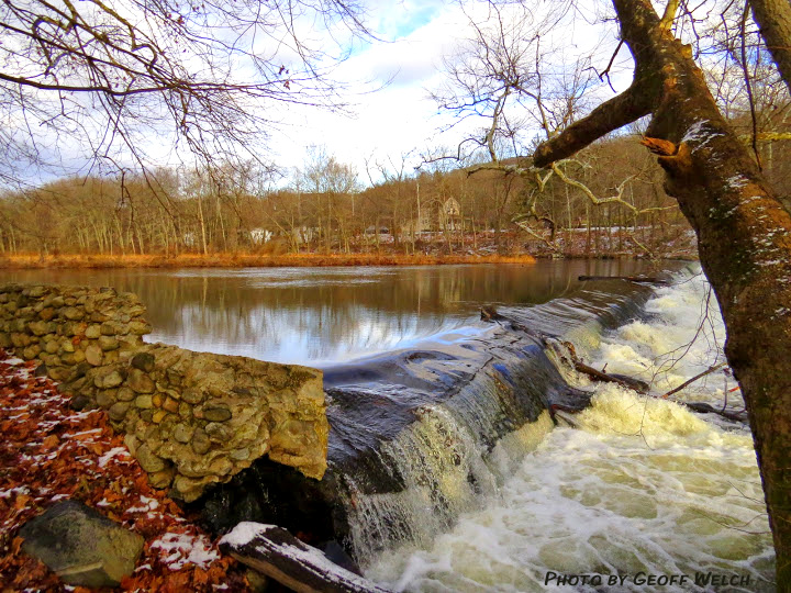
A walk through Brown’s Gate today leads down to the Ramapo River and the remains of Sloats Mill Raceway and Dam. Sloats Dam and Mill Pond above it are both on the NRHP.
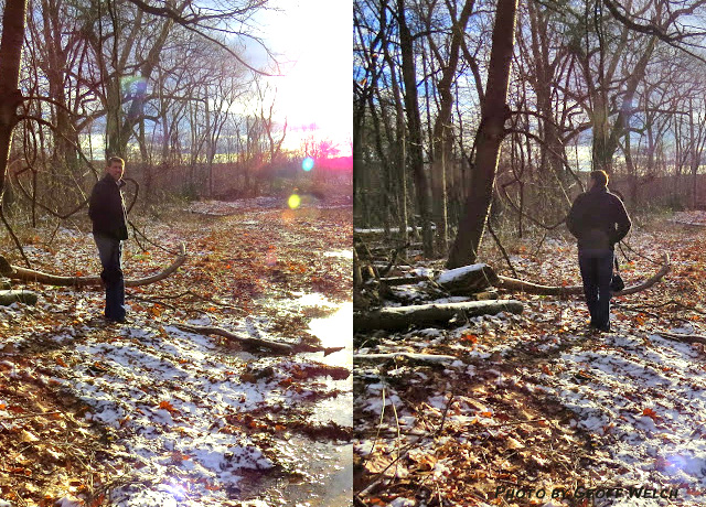
Ed Marse walks along the old mill’s raceway.
The land containing these sites is now part of undeveloped Rockland County parkland that involves some 45 total acres. In 1987, thirty-seven acres was acquired through tax delinquency and additional 4 acres donated in 1995. The Park was dedicated in September 1992. Named in honor of the late Eleanor Burlingham, an active environmentalist in Rockland County. The park follows the Ramapo River west to Seven Lakes Drive.
Present Use: Passive park. The Ramapo River is designated a New York State Wild, Scenic and Recreational River and is in a heavily wooded low-lying flood plain. The water quality is rated as Class A, which includes public consumption. Stony Brook, which runs down from Harriman State Park, also traverses this area, draining some 18 miles of watershed into the Ramapo River.
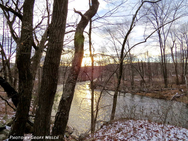
Sunset in Sloatsburg parkland along the Ramapo River.
Fishing, canoeing, bird watching and hiking. Ramapo River is stocked annually with trout. Sloats Pond is a popular fishing site with local residents. The Ramapo River is one of the few canoeable rivers in the metropolitan area.
Thanks to Geoff Welch and Edward Marse for this picturesque walk through Sloatsburg’s hidden park. Both are Sloatsburg residents and knowledgeable about the history of the village. Geoff Welch contributed photos as well as historical context for this article.
