
Forecast uncertainty. That big weekend snow has been hard to figure out. The weather squall line is right along Rockland County.
At this moment… areas most likely to miss this storm entirely, would be anyone from Kingston, on northward. Those most likely to see some accumulating snowfall, would be anyone from I-84 on south.
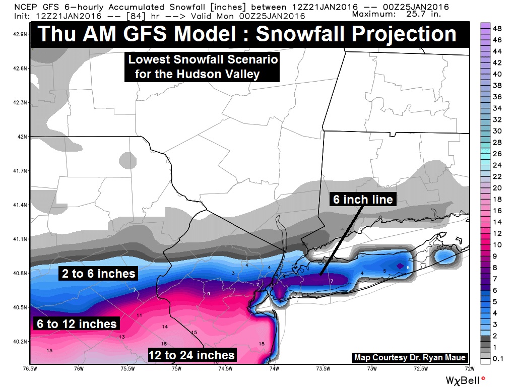
But the critical point to take home from this afternoon’s update… is that a very small shift of the track (just 30 to 50 miles) would result in dramatic changes to the forecast for the Hudson Valley.
— HudsonValleyWeather.com
Hudson Valley Weather has the system pushing south of the Hudson Valley, with snowfall accumulating south of Kingston/I-84 and then further south maybe piles of snow in the Delaware Basin and Washington, DC area.
Sloatsburg could receive anywhere from 4 to 12 inches of snow.
 An official NOAA Winter Storm Watch was declared Thursday for the Lower Hudson Valley and tri-state at least through Saturday. The nor’easter is expected to swing through Friday night and in to Saturday.
According to Hudson Valley Weather, the storm pattern resembles 2010’s February Snowmageddon Storm that had New York City and surrounding communities on near lock down. And then the storm blew a whisper of fresh powder through.
Updated briefing package on this weekends nor’easter. Detailed information available here: https://t.co/oKooRS1cTf pic.twitter.com/FxR0fNzWlV
— NWS New York NY (@NWSNewYorkNY) January 22, 2016
The storm’s flurry line bands around Rockland County — the southern pink bands are expected to get most of the snow. The near white of northern New York state should see sparse snowfall. If the storm bites, expect blowing winds, with icing and snow. Sunday should be a clear blue sky day. There are unknowns to the season’s first nor’easter. To use a Rumsfeldian weather description — we’re dealing with known knowns here, together with known unknowns and those ever present unknown unknowns. There are just things we don’t know we don’t know.
We’re watching #Blizzard2016 from space. Here’s a new satellite view from 2:35am ET today: https://t.co/6YTbRO5KiS pic.twitter.com/R8n3OemO3r — NASA (@NASA) January 22, 2016
